local-climate-response
Local Climate Indicators
This plugin uses the Geodesignhub API to download information about a design and / or diagrams to analyze it to produce a variety of views around heat and flood impacts at a local level.
Adding your project
This plugin can be added to your project in the Administration interface or at the time of Geodesignhub project creation.
Details
This plugin provides analytical capability for any diagram and design from Geodesignhub as a one-click integration, we use the API to download all the data.
Initial Database setup
Create an initial database.
Log in to the database as user postgres, from command line:
psql -U postgres
Then create the new database via commands below.
CREATE DATABASE localclimateresponse;
ALTER DATABASE localclimateresponse SET search_path=public,postgis,contrib;
\connect localclimateresponse;
CREATE SCHEMA postgis;
CREATE EXTENSION postgis SCHEMA postgis;
CREATE USER localclimateresponse;
ALTER ROLE localclimateresponse WITH PASSWORD 'localclimateresponse';
GRANT all privileges ON DATABASE localclimateresponse TO localclimateresponse;
ALTER DATABASE localclimateresponse OWNER TO localclimateresponse;
Motivation
The overall objective of this project is to develop a set of tools to focus on heat and flood response at a local scale. This dashboard will be flexible and will be used as a plugin to Geodesignhub and will analyze data provided by Geodesignhub. In addition, it will connect to external data platforms to download layers and data.
In addition to the metrics, a summary page would be generated for a design that presents a summary analysis of the metrics developed.
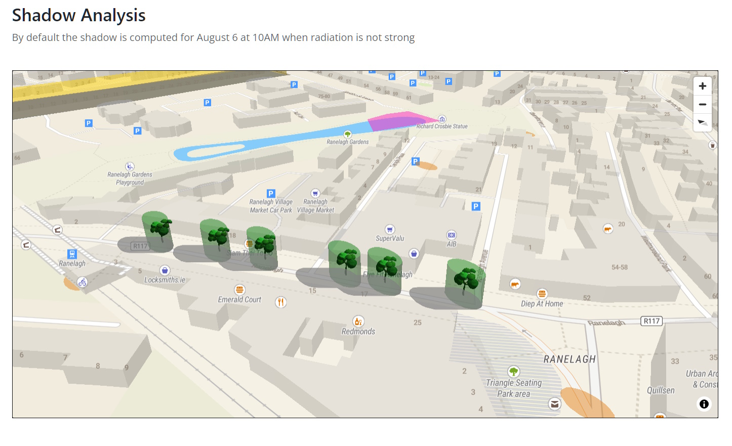
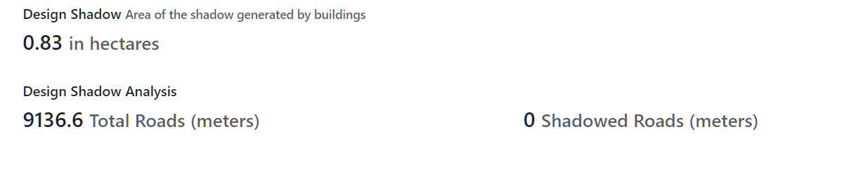
Shadow Analysis / Heat Response
We focus on heat / shadow response first and then to flooding mitigation response.
Screenshots
Shadows and trees
Analysis of generated shadows
Compatible with NBSAPI
![]()
This application is fully compatible with NBSAPI, allowing seamless integration and data exchange. For more information, please visit the NBSAPI website.